
Coordinate Permitting: Streamlined Workflow and Permit Management
Efficient Workflow Builder and Management
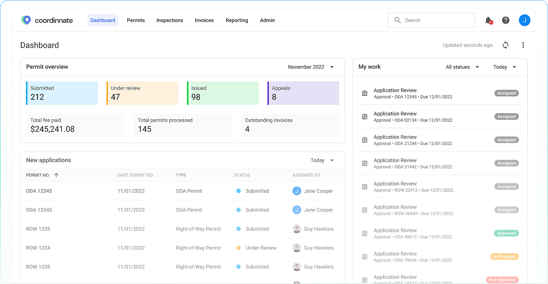
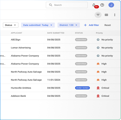
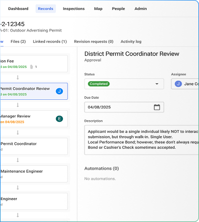
Coordinate Permitting offers a robust workflow and management module designed to help state and local agencies streamline right-of-way permit management. The platform integrates key functionalities to automate applications, coordinate stakeholders, and track regulatory compliance. By centralizing permit data and enabling seamless updates, Coordinate enhances transparency and efficiency. Builders can easily submit, review, and manage permits while permitting authorities gain powerful tools to monitor progress and enforce regulations. This comprehensive approach accelerates approvals, minimizes errors, and ensures adherence to industry standards.
Advanced Permitting Analytics and Reporting
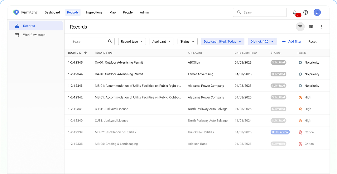
Coordinate Permitting provides agencies with comprehensive reporting and analytics to track and optimize performance across all aspects of right-of-way management. Key insights include permit volume, processing times, and staff productivity, allowing agencies to evaluate efficiency. By identifying trends and areas for improvement, agencies can enhance decision-making, streamline workflows, and allocate resources effectively.
Coordinate Permitting provides agencies with comprehensive reporting and analytics to track and optimize performance across all aspects of right-of-way management. Key insights include permit volume, processing times, and staff productivity, allowing agencies to evaluate efficiency. By identifying trends and areas for improvement, agencies can enhance decision-making, streamline workflows, and allocate resources effectively.
Configurable and Integrated Solutions
Designed for flexibility, Coordinate Permitting adapts to the unique needs of different government agencies. The system can be tailored to fit specific operational processes, ensuring an optimal workflow. Seamless API integration allows connectivity with other government systems, enabling synchronized data exchange and a unified permit management experience. By bridging disparate systems, Coordinate improves data consistency and operational efficiency.
Enhanced Code Enforcement
Coordinate Permitting supports efficient code enforcement by ensuring all necessary approvals and inspections are completed before work begins. The platform centralizes complaint and violation tracking, streamlining responses and resolution efforts. This proactive approach helps agencies maintain public safety, uphold city codes, and resolve disputes efficiently, preserving the integrity of public spaces.
GIS and Geospatial Support
With robust GIS and geospatial capabilities, Coordinate Permitting provides intuitive visualizations for better permit and land-use management. Users can access parcel histories, zoning details, and map inspection routes within a user-friendly interface. This integration enhances decision-making, simplifies inspection planning, and ensures compliance with zoning regulations, ultimately optimizing land management processes.
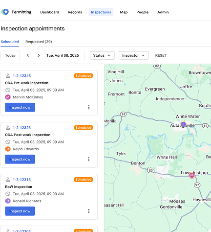
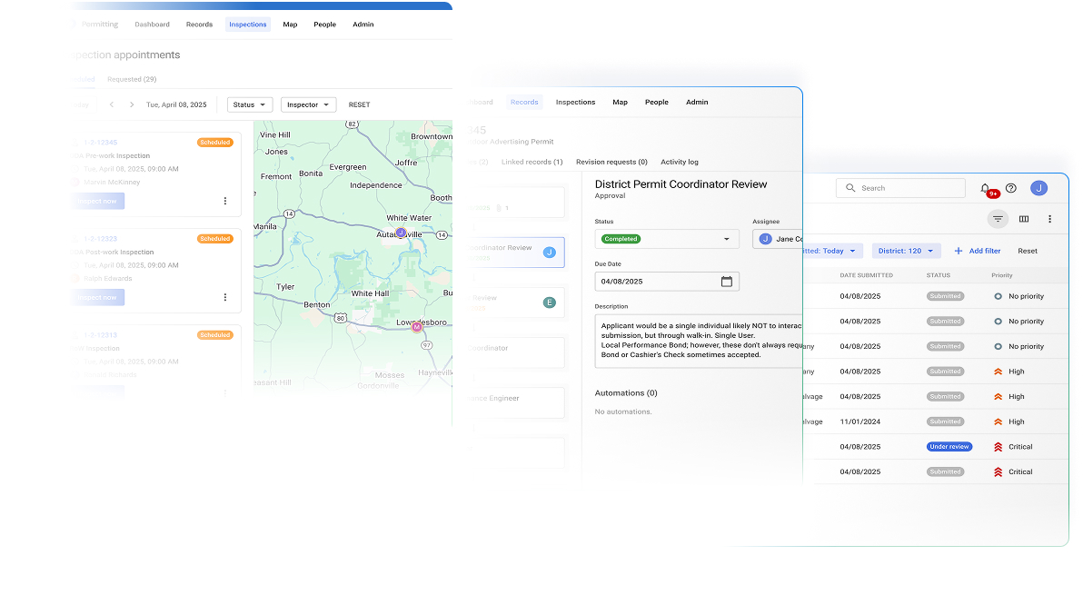
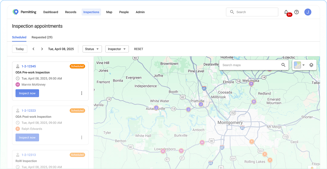
Mobile Inspection Support
The Coordinate Permitting Mobile App (available on iOS and Android) empowers inspectors with real-time access to documents, permits, and field data. Inspectors can conduct on-site assessments, update permit statuses, and log findings instantly, reducing administrative delays. This real-time data flow improves efficiency, supports immediate issue resolution, and strengthens regulatory enforcement.
Coordinate Permitting is the comprehensive solution for modern permit management, providing agencies with the tools to optimize workflows, enforce compliance, and enhance operational efficiency. Contact us today to see how Coordinate can transform your permitting processes.
